Licence-Free Boat Route: West Coast (Dias Islet & Sandy Beaches)
Licence-Free Boat Route from Katelios: Heading west to the southern shores of Kefalonia
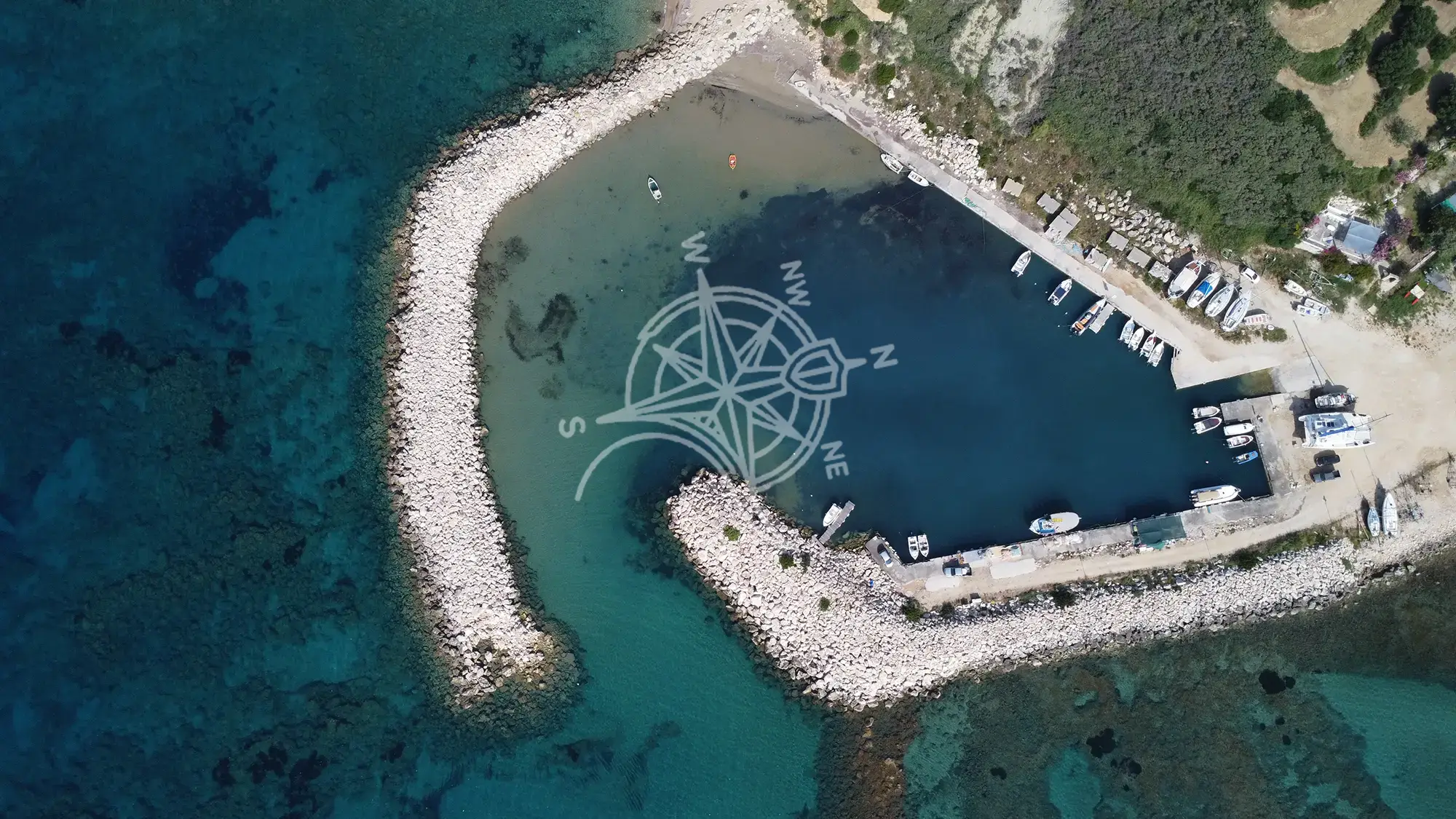
Renting a boat without a licence in Kefalonia from Katelios?
The West Route is the “classic” south coast adventure. It offers the perfect mix of everything: massive sandy bays, hidden pirate coves, dramatic white cliffs, and the ultimate finish line at Dias Islet.
Why choose this route? If you want variety, this is the one. You start with green hills and sandy beaches (Koroni, Lourdas), move into the “Cliff Zone” of Spartia with its dramatic clay backdrops, and finish at the exotic “Blue Lagoon” of Dias Islet. It is generally the safest and most protected choice during the typical summer afternoons when the North-West (Maistros) breeze picks up.
Conditions matter: your final route depends on wind/sea state and the operating limits in your briefing. On most days, the south coast feels more comfortable when the usual NW breeze (Maistros) picks up later
Distances from Katelios Harbour
Use these to schedule your day. Always confirm the allowed operating area during the briefing. Real-world time will vary with chop, throttle, load, weight, currents and detours close to shore, but these are good planning numbers.
- Psathi Beach ~ 2.9 nm ~ 12′ from Katelios
- Koroni Beach ~ 3.2 nm ~ 13′ from Katelios
- Lefka Beach — 4.0 nm ~ 16′ from Katelios
- Katsonas Beach — 5.0 nm ~ 20′ minutes from Katelios
- Sisia Beach — 5.3 nm ~ 21′ from Katelios
- Lourdas Beach — 6.3 nm ~ 25′ from Katelios
- Trapezaki Beach — 7.7 nm ~ 31′ from Katelios
- Agios Thomas Beach — 7.9 nm ~ 32′ from Katelios
- Pessada Beach — 8.2 nm ~ 33′ minutes from Katelios
- Klimatsias Beach — 8.5 nm ~ 33′ from Katelios
- Hatzokli (Spartia area) — 8.9 nm ~ 36′ from Katelios
- Cavo Liakas (Cape Liakas area) — 8.8 nm ~ 35′ from Katelios
- Nipsias — 9.2 nm ~ 37′ from Katelios
- Paliolinos Beach — 9.7 nm ~ 39′ from Katelios
- Dias Islet — 9.8 nm ~ 39′ from Katelios
Quick Planning Checklist:
- Best start: go early (calmer water, easier anchoring, fewer crowds).
- Ideal pace: 3–5 stops for a relaxed day; 6–8 stops if you move efficiently.
- Bring: water, hats, sunscreen, snorkel masks, waterproof phone pouch, and water shoes (mixed entries are common).
- Anchoring basics: choose sand patches where possible, keep distance from swimmers, and avoid anchoring on seagrass.
- Safety rule: if wind/chop increases, turn back early — don’t “push one more stop”.
1) Psathi Beach (2.9 nm)
38°04'33.0"N 20°41'43.5"E
This is your “systems check” stop. Psathi is a small, manageable bay just around the corner from Katelios. It’s the perfect place to stop for 10 minutes, adjust your bimini, check your anchor line, and take a quick dip to cool off before the longer cruising begins. It’s rarely crowded with boats, offering a gentle start to the day.


2) Koroni Beach (3.2 nm)38°04'49.6"N 20°41'25.9"E
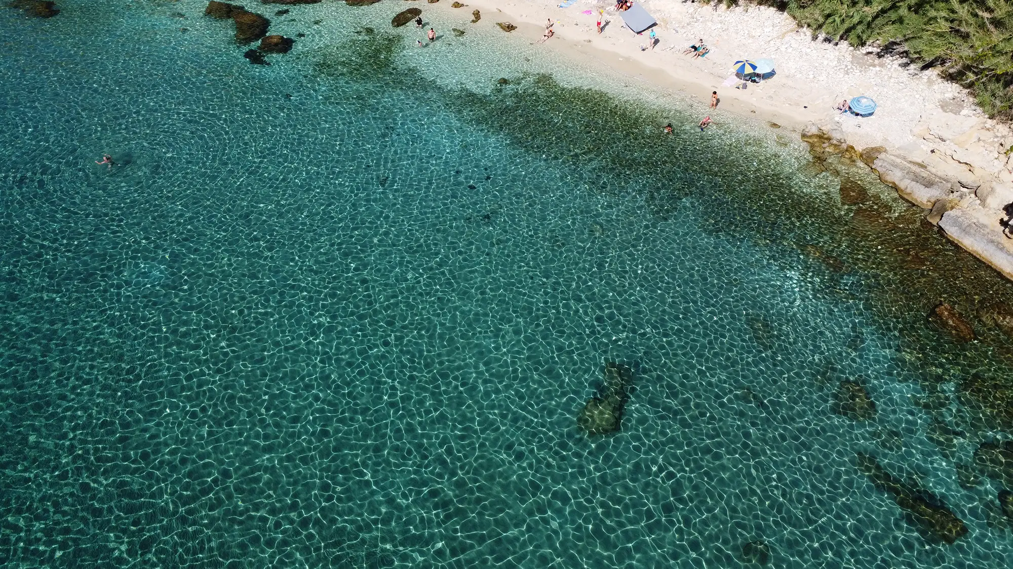
Koroni is a stunning natural amphitheater where green slopes meet the sea. Skipper’s Note: You might feel a sudden temperature drop here! Underwater freshwater springs flow from the base of Mount Ainos into this bay, making the water refreshing and crystal clear. It is one of the best anchorages on the route for a long, relaxed swim.
3) Lefka Beach (4.0 nm)38°05'22.5"N 20°40'31.2"E
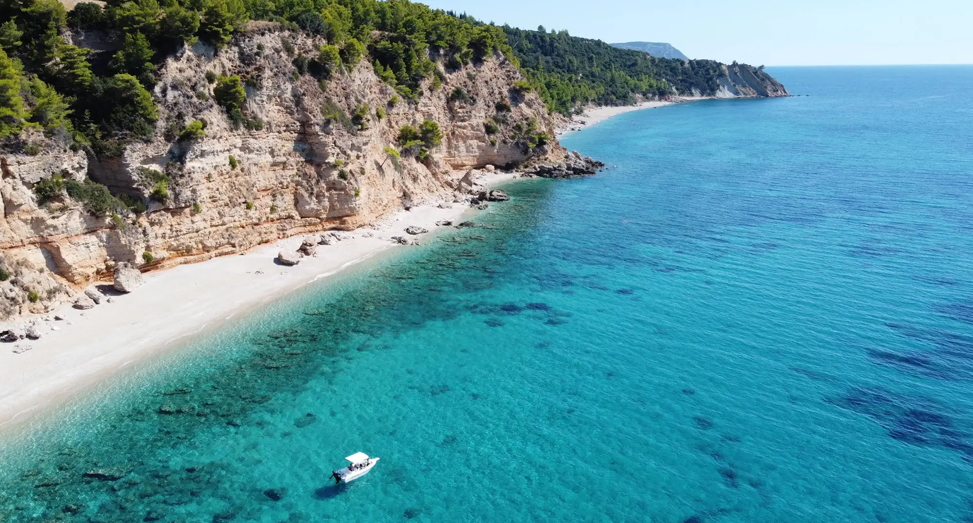
Accessible only by sea, Lefka (meaning “White”) is named after the bright white limestone rocks that surround it. Because these cliffs reflect the sun, this spot creates a “natural solarium”—it gets very hot and the water glows an electric blue. It feels much wilder than Koroni and is often empty.


4) Katsonas Beach (5.0 nm)38°05'47.4"N 20°39'33.4"E
A rugged, rocky cove that feels like a hidden pirate hideout. Unlike the wide sandy beaches, Katsonas is about structure: large rocks create underwater swim-throughs and pockets for fish. It’s a favorite for spearfishers and snorkelers who want to see something other than sand.
5) Sisia Beach (5.3 nm)38°05'55.7"N 20°39'14.1"E
Located directly below the historic Sisia Monastery, this is a serene, spiritual spot. The beach is a long strip of fine pebbles and sand, untouched by sunbeds or bars. It has a very “prehistoric” feel due to the untouched vegetation hanging over the cliffs. It is often the quietest major beach on the route.


6) Lourdas Beach (6.3 nm)38°06'42.8"N 20°38'12.2"E
Lourdas is the “Grand Bay” of the south—a massive sweep of white shingle and blue water. Navigation Warning: Because the bay is so wide and open, it offers zero protection from swell. If the wind is blowing from the South, do not try to anchor close in. If it’s calm, it’s a vibrant stop where you can watch the village life from the comfort of your deck.
7) Trapezaki Beach (7.7 nm)38°07'04.9"N 20°36'31.4"E
This is the shallowest part of the route. The water here is Caribbean-blue because of the white sand and shallow depth, but you must be vigilant. The sandbar extends far out. It is a stunning visual contrast to the deep blue of Lourdas.


8) Agios Thomas Beach (7.9 nm)38°06'57.4"N 20°36'08.8"E
Famous for its flat rock formations that look like slabs of pavement dropping into the sea. The Hazard: There is a distinct reef plate running parallel to the shore. Do not try to beach the boat here. Drop anchor in the deeper blue water and swim in. The reef is teeming with small fish, making it a top snorkeling spot.
9) Pessada Beach (8.2 nm)38°06'18.9"N 20°35'10.8"E
Pessada is a two-part destination: the ferry port and the hidden coves to the side. Do not enter the ferry port. Instead, head for the small, exquisite coves just east of the breakwater. These are some of the most protected spots on the coast, offering calm water even when the afternoon breeze picks up.

10) Klimatsias Beach (8.5 nm)38°06'10.9"N 20°34'31.5"E
You are now entering the “Cliff Zone.” The landscape changes from green slopes to dramatic vertical clay cliffs. Klimatsias is the main beach of Spartia, protected by a long pier. It’s a safe, easy stop with excellent sand holding.
11) Hatzokli (8.6 nm)38°06'00.5"N 20°34'10.0"E
Located just past the Spartia pier, Hatzokli is visually striking. The white/grey clay cliffs drop vertically into the turquoise sea. It feels exotic and raw. The contrast between the white clay and the blue water makes for incredible photos.


12) Cape Liakas area (8.8 nm)38°05'20.2"N 20°34'02.2"E
Navigation Hazard. This cape marks the turning point. A rocky reef extends underwater from the tip of the cape. Do not cut the corner. Keep a distance of at least 200m from the shoreline as you round it. The landscape here is lunar and sharp.
13) Nipsias (9.2 nm)38°05'29.3"N 20°33'24.6"E
After rounding the cape, you find Nipsias. It’s a wild, rocky stretch that feels completely disconnected from the rest of the island. It’s rarely visited, making it a good spot if you want to be the only boat in sight.


14) Paliolinos Beach (9.7 nm)38°05'46.6"N 20°32'48.4"E
Paliolinos is a labyrinth of large rocks and small pools. It’s very popular with locals for fishing and exploring. The seabed is a mix of rock and sand patches. It serves as the gateway to the Dias Islet channel.
15) Dias Islet (9.8 nm)38°05'06.7"N 20°32'40.2"E
The Final Destination. Dias is a small islet topped with a tiny church, completely separated from the mainland. The passage between the islet and the mainland is known locally as the “Blue Lagoon” due to its shallow, electric-blue water.

FAQ about the western route for licence free boat rentals
Yes, mostly. In the summer, the prevailing wind is the “Maistros” (North-West). The high mountains of the South Coast block this wind, keeping the sea relatively flat near the shore.
Skipper’s Warning: However, if the wind is coming from the South (Ostria), this entire coastline becomes very choppy. In that case, we might advise you to switch to the East Route.
Often it’s more comfortable than exposed west-facing beaches, but wind can still push you offshore or build after midday. Plan to return early if it strengthens.
Yes. You need to be careful at Trapezaki and Agios Thomas.
-
Trapezaki: The sandbar is very shallow (1m) for a long distance out. Keep your engine trimmed UP and move slowly.
-
Agios Thomas: There is a rocky reef running parallel to the shore. Do not try to beach the boat—anchor in the deep blue water and swim in.
Keep your eyes peeled at the very start of your trip, between Katelios and Koroni Beach. This quiet stretch is a feeding ground for the Caretta Caretta turtles. If you spot one, please cut your engine to neutral and observe from a distance—never chase them.
Ready to schedule your boat day?